A bike tour from Portland - slow travel
In mid-September, I began a climate-friendly and slow travel adventure from my home in Bellingham to Oregon. Most of the adventure occurred in Portland and was largely car-free. I biked, walked, bussed, and rode the train. I carpooled with Barney for parts of the trip and used ride hailing services once when I was traveling solo. I brought my bike so I could go on a bike tour from Portland to Corvallis, and this was totally worth it despite managing all the extra “stuff” when I wasn’t pedaling.

When Preserving the Historic Road International Conference concluded in Portland, I pedaled toward Corvallis where my parents live. This was a new adventure. I have pedaled to Corvallis numerous times from Eugene, which is 50 miles, but never from Portland, which is about 70 miles away.

Departure from Portland. I had everything from the conference plus four too many books that I picked up while I was out and about in town. #stuffmanagement
There are two main bike routes out of the Portland area south to Champoeg State Heritage Area and the Willamette Valley Scenic Bikeway. One route stays east of the Willamette River, goes through Oregon City, the Territorial Capital, and crosses I-5 in Wilsonville. The other route crosses to the west side of the Willamette River in Portland and bridges I-5 after several uphill blocks.
On the climb to I-5, I stopped to catch my breath. Slow travel could mean many things. In that moment, what was already a slow way to go was slower from the steepness, and that was fine. I hadn’t departed until almost noon, and the cloudless sky dished out glaring light in the 80-degree heat, making an unseasonably warm day hot. I hoped to stop for the day somewhere with a motel near Champoeg (pronounced shampoo-y), about 35 miles.
Slow travel invites a vacation from technology and a willingness to be uncomfortable.
Before departing, I scribbled barebones notes to get me through suburbia and taped the paper to my handlebars. At a major intersection with Capitol Hwy – a confusing T-junction with an extra minor road – I couldn’t track where to go. My notes said, ‘L Capitol Hill.’ I turned left. As I gathered speed on the downhill, I noticed I was on Beaverton Hillsdale Hwy. I stopped and pulled out my phone. Sure enough, I needed to backtrack. At the major intersection, I turned onto the minor road, Capitol Hwy, but it still wasn’t the right road, Capitol Hill Rd. I backtracked again. Made another wrong turn. Then, I realized I needed to backtrack further. Capitol Hill Rd was two streets before Capitol Hwy at the major intersection, a non-descript, unsignalized, unsigned turn. Of course! There’s a difference between Hwy and Rd (and Hill matters too), but I’d missed it.

The confusing intersection with my numbered decision points and turns. I pedaled north-ish on Bertha and stopped at the traffic signal at Capitol.
Somewhere still in the thick of suburbia, a climb loomed. I needed a break. I pulled off onto a shaded grassy area at the corner of a busy intersection and ate an energy bar. The ground was hard and the grass was prickly dry, but I welcomed relief from the hot sun.

Up the hill and further west, I stopped at a signal. I stood in awe of the intersection’s expanse, which seemed as wide as the Interstate. The light changed, and that’s when I noticed the name of the highway. I was supposed to turn left. I had ample time crossing what seemed like sixteen lanes of traffic to the other side of the intersection and followed the road into the first traces of countryside – rolling green hills and fields edged by residential developments. My primary thought was about my difficulty and confusion navigating through and out the city. Secondarily, I was frustrated that after two hours of pedaling, I was barely out of the ‘burbs.
The countryside road was busy, the traffic constant, and I soon came upon a town with torn up road shoulders. I pedaled and pedaled just wanting to get through it. Outside of town, a road sign brought me to a stop. I didn’t recognize Tualatin Sherwood Rd. I hadn’t turned anywhere. How could I be off route again? Did I miss a turn? I pulled out my phone. I had indeed missed a turn. I backtracked into the clog of torn up road, town and traffic looking for Baler Way. I stopped again thinking I’d gone too far wondering why I hadn’t seen a sign for my turn. I looked at my phone. I overshot it by a block and looped through parking lots, hefting my bike over a landscaped barrier. I checked my phone to make sure I was at the proper intersection. There were no street signs. No wonder I passed it twice without knowing.
I exited the torn up main drag and followed Baler Way into the town’s residential area. I got turned around again. Baler Way made a U. I pulled out my phone again, sorted out how to get out of the area and took off. I made it to a park where my route seemed to disappear, but I took the opportunity to use the facilities, refresh my water, and eat an energy gel.
Thank you Stella Olsen Memorial Park. I needed you.
I was hot and tired. I looked carefully at my phone for direction. The route went through the park, into a residential area, then put me on a highway for several miles. I backtracked in the park once and again in the residential area. American flags hung from many of the houses with lush green lawns. Not a blade of grass was out of place nor were there intruding weeds. I could see why people would want to live in a place like this, they could have a house, a yard, and a three-car garage. The streets felt like an extension of the park. I didn’t see a homeless person or evidence of a camp anywhere.
I followed a truck to Pacific Highway and turned left. Did the fact I was on a bike suggest a political lean the way the flags on the houses signaled one to me?
On Pacific Highway, I left the town and houses behind but not the traffic. I pulled to a stop in a shady spot on the shoulder.
I was done. Hungry. Exhausted. Too many wrong turns. Too much town and traffic. Too loud. My sitting parts were sore. I looked at my phone for lodging. Newberg, Oregon, known for its wine, had a Travel Lodge near the turn to Champoeg, so I reserved a room there.

I only backtracked once to the motel. My cycle computer read 34.6 miles. A younger me would have been embarrassed to stop with that day’s distance, but the now me congratulated myself on paying attention to my body’s signals.
A pleasant staff person greeted me. My room was clean and cool. I was too hungry to shower. I changed into clothes at the top of a pannier and walked next door to the Black Bear Diner for dinner. I ordered an iced tea and taco salad and read the first few chapters of Bad Feminist by Roxane Gay while I sipped tea and waited for my salad.
Salad. How long does it take to make a salad? Probably a long time if you grow the lettuce. I was hangry, and my ill humor was made worse when I imagined the Universe chuckling about the speed of food delivery as part of my experience: ‘You want slow? Check out the length of time on this salad.’ Forty-five minutes after I ordered, the waitress brought my salad and said, “Sorry that took so long.” I considered asking for a reason but thought that would sound snippy, so I kept the cutting words to myself.
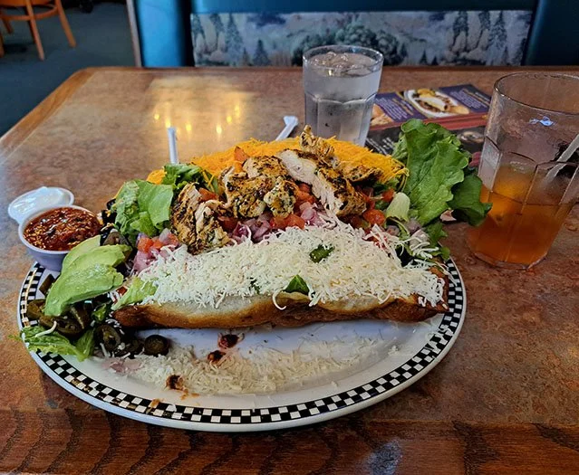
Platter with taco salad heaped high. Water and iced tea in the background. The portions at the diner were excessive.

After the fact salad - lettuce garnish in an empty flour shell bowl. I was a touch embarrassed by having consumed the quantity of food that this salad was.
When I talked to Barney that night, he asked, “How far are you from Corvallis?”
I put my phone on speaker and opened Maps. “69 or 72 miles. That can’t be right. I thought that’s how far it was when I left this morning.” I recalculated my directions to include my departure point that morning. “Darn it. I guess it was 100 miles from Cathy’s house. How did I miss that? Whatever. I’ll see how far I get. My plan is to leave early and get out ahead of traffic.”
“I like that.”
Barney would be driving down from Bellingham the next day, and we planned to intersect in Corvallis. With the new information about the distance ahead of me, I wasn’t sure Corvallis was reasonable. Raw sitting parts are misery.
“When is your appointment in Salem?” I asked.
“Around 3:30 p.m. I’d love to find you there.”
“We’ll see how it goes. I’ll let you know when I leave in the morning and when I get to Salem. Mom offered to pick me up somewhere if I need a ride, but that was before their Subaru was stolen.”
“That’s right. When did that happen?”
“Four days ago.”
“Well, let me know.”
“You bet.”
The Travel Lodge had a decent spread for breakfast – including organic peanut butter and a fridge with breakfast burritos and croissant breakfast sandwiches. Still full from my enormous taco salad dinner, I had one oatmeal packet, yogurt, a banana and tea and got back on the road in my same stinky clothes from the previous day. Later, I wished I would have eaten a more substantial breakfast or brought something with me. I was relearning how to tour.

I loved that the notepaper at the Travel Lodge said ‘TODAY’S ADVENTURE.’ A good title for my cue sheet. (I travel with two to three kinds of tape and used the double-sided clear tape for the cue sheet.)
I entered highway traffic. On a short climb, I swerved around a dead porcupine. I didn’t want to roll over the quills and puncture a tire. I’d never seen a roadkill porcupine and would have taken a picture of it had the shoulder been wider and the road less busy. I wondered about porcupine habitat and how this creature ended up on this highway.
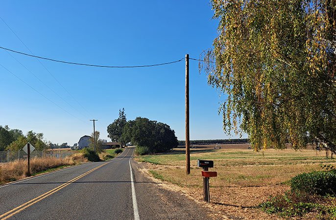
Four miles from the motel, I turned onto the road to Champoeg. The traffic noise stopped, and I had the road to myself. My whole body unclenched.
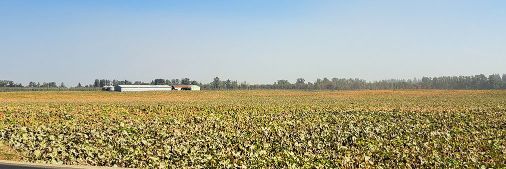
A mile further, I turned south onto the Willamette Valley Scenic Bikeway. Birds twittered. The morning glittered. Trees and agriculture fields with wooden barns textured the landscape. I breathed deeply. The air was outdoors fresh – something light with a trace of soil, chlorophyll, and water. I pedaled in joy. This was what I hoped for a bike tour experience.
Hardly any vehicles came by on the road. I stopped to take pictures. A couple walked on the road ahead. He threw an arm over her shoulders then hugged her. Sweet, young love. I passed with a smile.
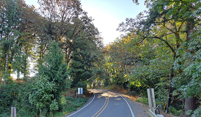
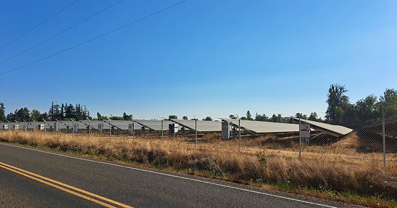
Without the traffic and attention to wayfinding – the scenic bikeway has few turns plus it’s signed, I relaxed into the pleasure of moving through the landscape. Wooded roads. Field roads. Solar farm. Filbert fields. Pumpkin patch. Wetland area.
I reflected on my experience at Preserving the Historic Road International Conference. I noticed in the absence of traffic and wayfinding questions, I could be with my thoughts. I looked forward to answering a question someone asked me at the conference as a blog post. I noticed my body, too. My sitting parts were sore. I was hungry. I ate snacks, but they didn’t stop the gnawing in my belly. I rose from my saddle regularly.
I rolled into Salem at lunchtime focused on finding a substantial meal with veggies. The Indian restaurant was closed. I went around the corner to a pizza place. I sat outside in the shade of a pole and kept an eye on my bike. I finished and went next door for an iced tea that I sipped at a shady outdoor table.

Pizza is not my first choice for nourishment, but I ate both of these slices in one sitting. I think it was the equivalent of eating a medium, 14” pizza.
From Salem, the scenic bikeway went west then east over I-5 where there were services in Jefferson, a place that didn’t seem big enough to be a town based on the map. From there, the route went west again, back over I-5 into Albany. Following this route, Albany was about 35 to 40 miles from Salem, the same distance I’d traveled from Newberg. My legs could handle it, but I didn’t want to ask that of my sitting parts.
I called Mom. “Talk to me about how you might pick me up if I was interested. No one found the Subaru yet, is that correct?”
“That’s correct. I have some recycling to drop off, and we could put the seats down in the Prius and put your bike in the back.”
“Good to know. Is Jefferson a town?”
“I’d say more of a hamlet.”
“I’ll noodle on this and get back to you.”
I called Barney. I wanted to ride more, but I didn’t want to commit to riding to Jefferson or Albany.
“I’m 30 minutes from Salem,” Barney said. “I have some things to do on my computer before my meeting, but I’d love to see you. If you stay put, I’ll meet you there.”
“I’d like to ride a little more but not much.”
“How will I find you?”
We talked through our rendezvous until I decided it wasn’t a big deal to drink my tea and wait for him to show up. I texted Mom and told her we’d see her and Dad around 5 pm.

Case Creek, my favorite scenic spot on the trip.
I accepted my tour was complete. Slow travel isn’t necessarily about getting from point A to B. This slow travel experience was about embracing the unplanned and unexpected nature of my journey. My plans weren’t ruined because I didn’t reach Corvallis – it was just a place I was aiming toward.
I sipped my tea. Even though I wanted to pedal another mile so I could say I pedaled forty miles, it didn’t matter. I was satisfied with my effort and looked forward to seeing Barney.